Loan Surveys

Most Loan Surveys are required by a bank as a way to verify that YOU are getting what THEY loaned you the money for. These can range from simple boundary surveys of land itself, to an existing dwelling. Sometimes banks require a surveyor to stake out a house for construction followed by an “as-built” verification on the finished structure for the bank/lender’s records.

ALTA Surveys

American Land Title Association, or ALTA, surveys have specific minimum standards adopted by the ALTA/ACSM (American Land Title Association/American Congress for Surveying and Mapping). These show site improvements, easements, rights-of-way and other elements impacting land ownership and these generally pertain to investment properties.

Construction Stake-Out
and Site Plans

Most construction sites are designed beforehand and in order to ensure that the site is being built as designed, a surveyor will lay out various components being built. Surveyors and contractors work closely to solve/prevent problems with the ongoing construction. Once construction is complete, the surveyor will often verify elevations different aspects of the design to ensure that they are built to specifications. These are often referred to as “as-built” surveys.

Topographical Surveys

Topographical surveys are detailed, three-dimensional portrayals of a piece of land. Often, this includes location and elevations of the lay of the land itself, improvements on, above, or below the Earth’s surface.

Major & Minor Subdivisions
Family Splits

The definition of major subdivision and minor subdivision varies depending on your local governing body. Different requirements may need to be met before a subdivision can formally take place and surveyors know who to contact regarding this information. Major subdivisions include developments and business parks, which often require a surveyor to stake or lay out the site and produce a record plat of the property being subdivided. Minor subdivisions include family inheritance splits, buying/selling a portion of an existing tract or parcel, and various other scenarios.

Boundary Retracement

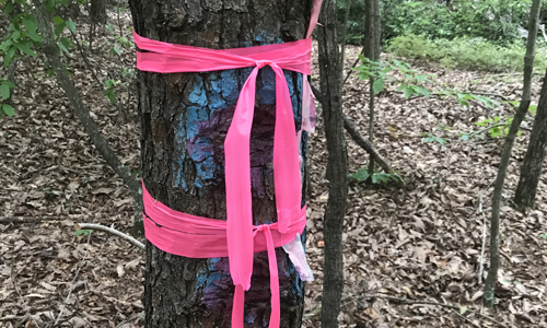
Boundary retracement is the verification of property corners and the re-setting any that are missing due to various circumstances. A surveyor can mark property lines and corners while retracing the boundary.

Our Goal

ALS strives to uphold professional standards to any project, no matter how large or small.